Previous: #5 Features for Images in a Folder
Next: Not yet available
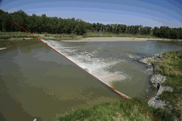
This is the sixth in a series of videos I am creating of the research I am performing under the direction of University of Nebraska Lincoln Professor Troy Gilmore to determine whether we can use images taken at the weir on North Platte River at the Nebraska-Wyoming State Line to replicate measurements of discharge and stage by extracting features from the images and using measurements from USGS sensors as ground truth.
This is the first pass of the weir finder. Notice that it starts missing at night and that it is pretty good, but not perfect. We will refine this.
Leave a Reply